Wake Island
Photos
18 Photos
Per Page:
Filter Categories
All
Filters
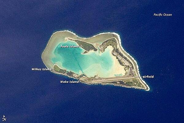
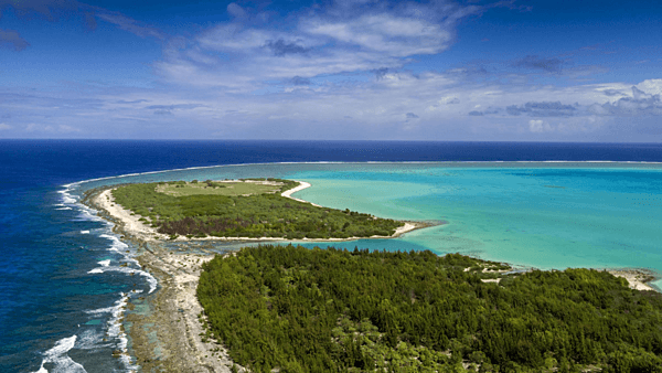
The atoll of Wake Island is composed of Wake Island proper and the smaller Peale and Wilkes Islands for a total land surface area of 6.5 sq km (2.5 sq mi). Like many atolls in the Pacific, the islands and associated reefs formed around a submerged volcano. The lagoon in the center of the islands marks the approximate location of the summit crater. Image courtesy of NASA.
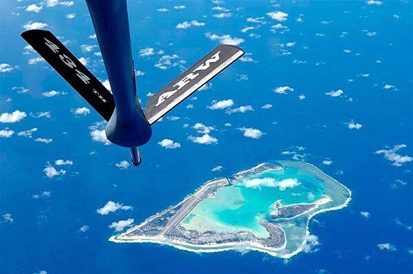
Dramatic photo of Wake Island as seen past the refueling boom of a Boeing KC-135 Stratotanker aircraft. The view of the island is from the east. Photo courtesy of the US Air Force.
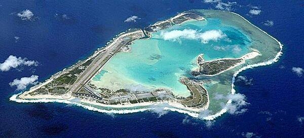
A closer view of Wake Island and its facilities. Photo courtesy of the US Air Force.
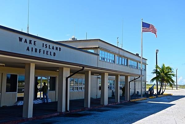
The airport terminal building on Wake Island. The island is a strategic air facility in the Western Pacific enabling the US to project power into the region. The airfield on Wake Island normally supports about 400 aircraft visits per year. Photo courtesy of the US Air Force.
United States Marine Corps memorial to the defenders of Wake Island in December 1941. For 16 days, beginning 8 December 1941, a combined military force of Marine ground and air units, Naval aviation personnel, and an Army detachment - augmented by civilian contractors - resisted near constant attacks by Japanese forces. In the end the island defenders were overwhelmed by the Japanese forces who then occupied the atoll until the end of World War II. Photo courtesy of the USMC / Sgt. Bill Lisbon.
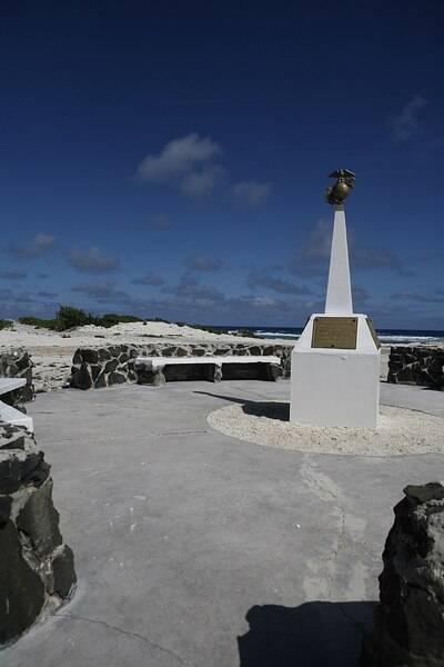
United States Marine Corps memorial to the defenders of Wake Island in December 1941. For 16 days, beginning 8 December 1941, a combined military force of Marine ground and air units, Naval aviation personnel, and an Army detachment - augmented by civilian contractors - resisted near constant attacks by Japanese forces. In the end the island defenders were overwhelmed by the Japanese forces who then occupied the atoll until the end of World War II. Photo courtesy of the US Air Force.
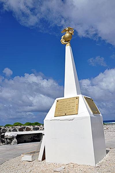
Wake Island memorial to 98 civilian contractors killed by Japanese soldiers during their occupation of the island in World War II. Photo courtesy of the US Air Force.

An aerial view of Wilkes Island, one of the three islands making up Wake Atoll. Located on the west side of the atoll, Wilkes Island is now home to a bird sanctuary of approximately 12 different species of both sea and shore birds and about 40,000 birds total. This conservation effort is a joint project between the US Air Force and the US Fish and Wildlife Service of the Department of the Interior. Photo courtesy of the US Air Force.
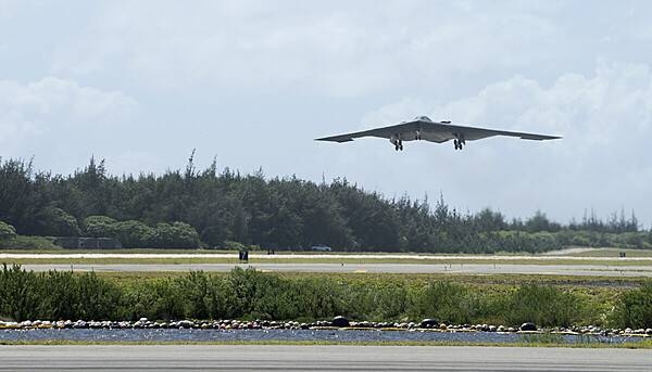
A US Air Force B-2 bomber takes off from Wake Island airfield during a routine training exercise. The airfield on Wake Island is a strategic air facility that supports the projection of US military power into the Western Pacific. The airfield on Wake Island normally supports about 400 aircraft visits per year. Photo courtesy of the US Air Force.
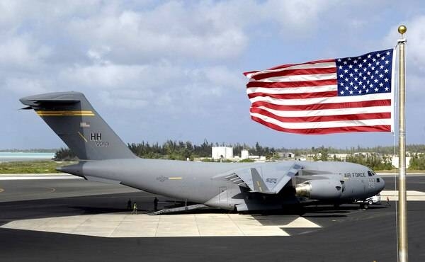
A C-17 Globemaster III on the flight line at Wake Island Airfield. Image courtesy of the US Air Force/ TSgt Shane A. Cuomo.
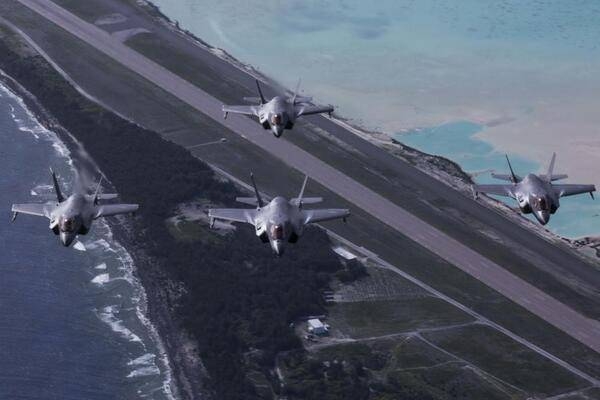
F-35B Lightning IIs with Marine Fighter Attack Detachment 211, the Wake Island Avengers, 13th Marine Expeditionary Unit (MEU), fly over Wake Island during a regularly scheduled deployment of the Essex Amphibious Ready Group (ARG) and the 13 MEU, 1 August 2018. Image courtesy of the US Air Force.
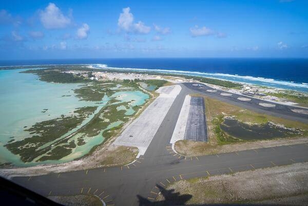
Taking off from Wake Island. The shadow of the aircraft lifting off is that of a C-17 Globemaster. Image courtesy of the US Air Force.
Page 01 of 02