Spain
Photos
98 Photos
Per Page:
Filter Categories
All
Filters
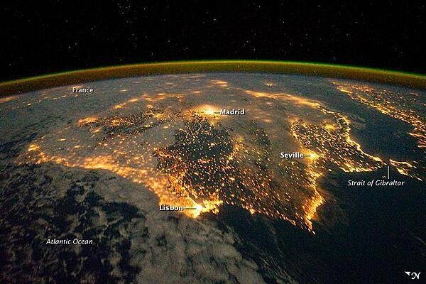
The city lights of Spain and Portugal define the Iberian Peninsula in this photograph taken from the International Space Station (ISS) on 4 December 2011. Several large metropolitan areas are visible, marked by their relatively large and brightly lit areas, such as the capital cities of Madrid, Spain - located near the center of the peninsula's interior - and Lisbon, Portugal - located along the southwestern coastline. The ancient city of Seville, visible at image right to the north of the approximately 14 km (9 mi)-wide Strait of Gibraltar, is one of the largest cities in Spain. The view is looking outwards from the ISS towards the east.
The network of smaller cities and towns in the interior and along the coastline attest to the areal extent of human presence on the Iberian landscape. Blurring of the city lights is caused by thin cloud cover (image left and center), while the cloud tops are dimly illuminated by moonlight. Though obscured, the lights of France are visible near the horizon line at image upper left, while the lights of northern Africa are more clearly discernable at image right. The gold to green line of airglow, caused by excitation of upper atmosphere gas molecules by ultraviolet radiation, parallels the horizon line (or Earth limb). Image courtesy of NASA.
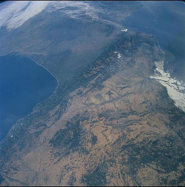
The Pyrenees (whose highest point is Spain's Pico d'Aneto 3,404 m; 11,168 ft) extend from the Bay of Biscay (west, left) to the Gulf of Lyon (east, right). Spain lies south of the range, France is to the north, and Andorra is entirely within the range near the eastern snow patch. There is a long history of mining in the Pyrenees - tin, tungsten, talc, fluorite, barium, and gold. Image courtesy of NASA.
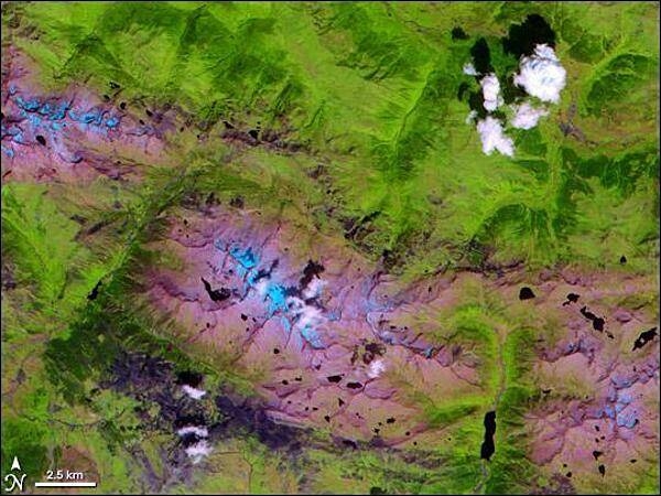
The Alps may be more famous, but the Pyrenees have been around much longer - tens of millions of years longer, in fact. These mountains formed between 100 and 150 million years ago when the landmass that Spain occupies pushed into the one that France occupies. The mountains have served as a natural barrier between the Iberian Peninsula (Spain and Portugal) and the rest of Europe ever since. Stretching east to west across 430 sq km (166 sq mi), the Pyrenees fall mostly within Spain's borders, but also pass into the independent state of Andorra. The NASA Terra satellite captured this image of part of the Central Pyrenees - the highest part of the range - on 1 August 2000. In this false-color image, clouds appear white, snow appears pale blue, vegetation appears green, and bare ground appears as either pink or dark, bluish-purple. Water on the ground appears dark blue (or nearly black). In this shot, the vegetated areas are mostly to the north, and the peaks to the south are mostly bare rock. Patches of dark purple that are visible along rivers and in valley floors are probably developed areas. Image courtesy of NASA.
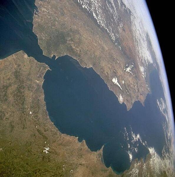
The Strait of Gibraltar provides a natural physical barrier between the countries of Spain (north) and Morocco (south). This photo shows the mountainous northern coast of Morocco and the coastal mountains of southern Spain, including the dagger-shaped, snow-covered Sierra Nevada Mountains of southeastern Spain. The British territory of Gibraltar is located on the thin, wedge-shaped peninsula on the east side of the bay in the southernmost protrusion of Spain. The city of Ceuta is a Spanish enclave on the extreme northeastern coast of Morocco. Image courtesy of NASA.
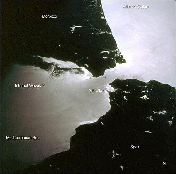
This space shuttle photo was taken near sunset. Two packets of tidally-generated internal waves are highlighted by sunglint off the surface waters in the Strait of Gibraltar. The older packet (labeled) contains at least 14 waves, which can be counted like tree rings. A younger group is forming near the middle of the strait (marked by the carat south of Gibraltar). The waves are generated as a diurnal tidal pulse flows over the shallow Camarinal Sill at Gibraltar. The waves flow eastward and refract around coastal features; they can be traced for as much as 150 km. Image credit: NASA.
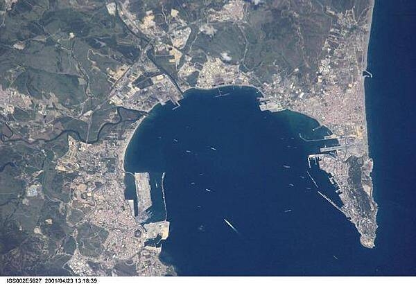
Algeciras, Spain (left), the Bay of Gibraltar (Bahia de Algecira), and Gibraltar itself (right) are featured in this detailed vertical view over the European side of the Strait of Gibraltar. Ship traffic in the bay can easily be seen. Image courtesy of NASA.
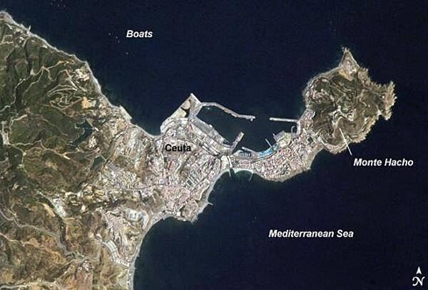
The small Spanish enclave of Ceuta occupies a narrow isthmus of land on the African side of the Strait of Gibraltar; the rest of the surrounding territory is Morocco. Densely populated Ceuta occupies the center of the image, its pink and white residential and industrial rooftops occasionally broken by patches of green - city parks and athletic fields. North of the city, seawalls enclose a small bay and harbor. On the beach, bright blue patches are large water parks. The Spanish fort at Monte Hacho on the eastern isthmus tip commands a clear view of the Strait. Image credit: NASA.
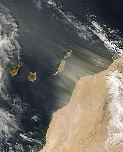
Saharan dust blowing off the west coast of Africa and over the Canary Islands (a Spanish archipelago) on 11 November 2006. The horizontal line is the border between Morocco (to the north) and Western Sahara. The plumes of dust are more distinct off the coast of the former than the latter. The fine particles blow to the northwest, and although the islands of Tenerife and Gran Canaria appear unaffected, the neighboring islands of Fuerteventura and Lanzarote are receiving a strong dusting. Click on photo for higher resolution. Image courtesy of NASA.
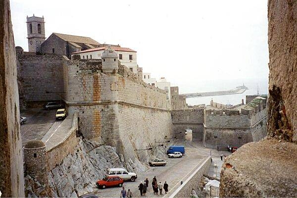
Scene in the old walled town of Pensicola in Andalusia.
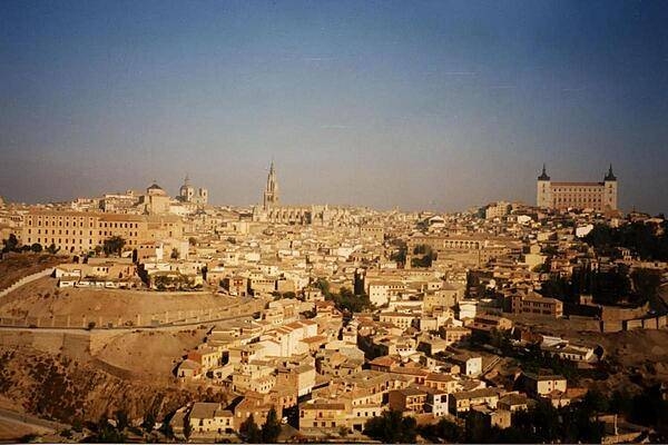
A view of the city of Toledo. On the right is the castle-fortress known as the Alcazar.
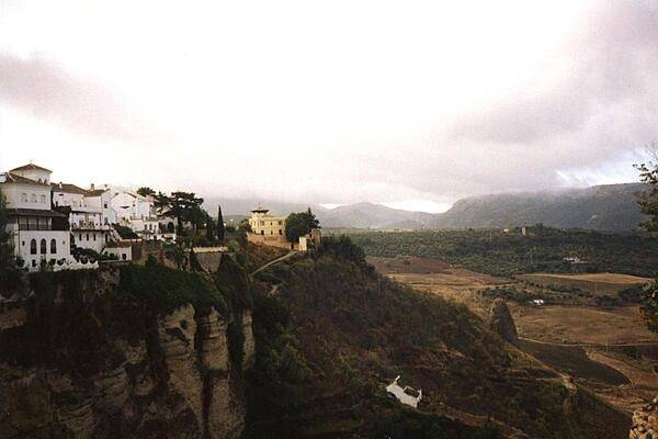
Ronda, a city perched on cliffs in the province of Malaga. This mountainous area of Andalucia is roughly 750 m (2,500 ft) above sea level.
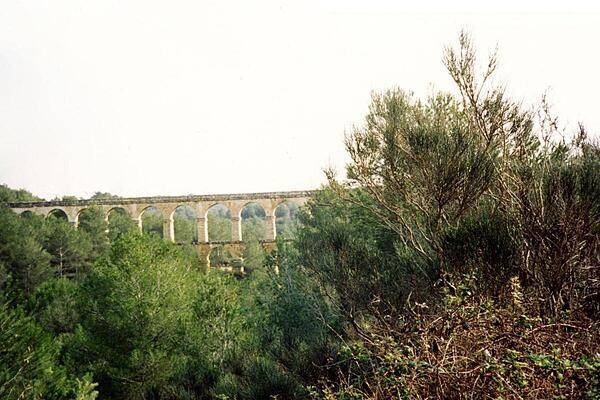
Well-preserved Roman aqueduct a few kilometers north of the city of Tarragona.
Page 01 of 09