Mali
Photos
4 Photos
Filter Categories
All
Filters
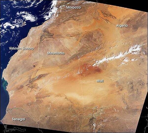
A remarkably clear satellite image of northwestern Africa vividly displays the extent of the Sahara. To the north are the dark brown Atlas Mountains of Morocco, to the west is the Atlantic Ocean, and to the south is the semi-arid (light brown) Sahelian region. Mali extends across the arid desert, through the Sahelian region, and into a fertile southern Sudanese region. Photo courtesy of NASA.

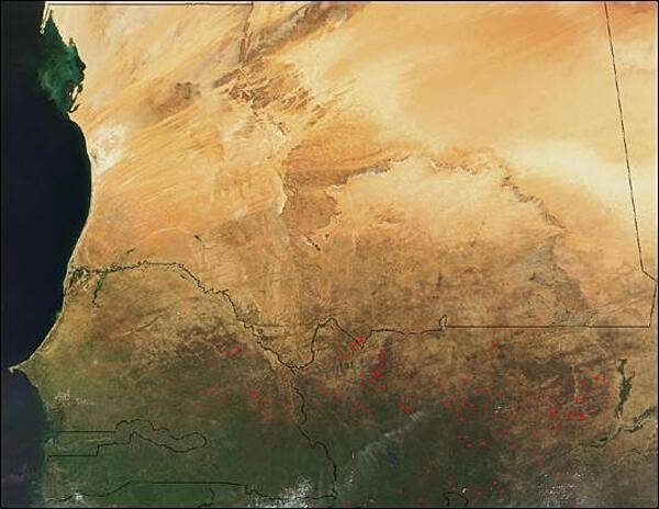
This satellite photo shows dozens of fires burning in the African countries of Senegal (left) and Mali (right). To the north is Mauritania. Photo courtesy of NASA.

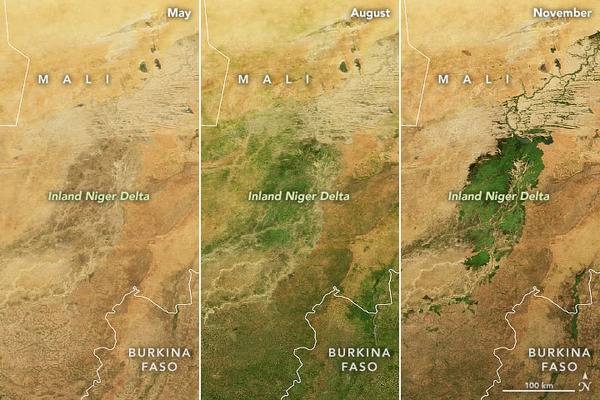
A seasonal emerald in the Sahel - the Inland Niger Delta. It is one of the world’s most productive wetlands, even though it is mostly dry for nearly half of each year. Depending on the abundance and timing of rainfall upstream, the inland delta of the Niger River in Mali typically floods with water from roughly August to December. The result is a seasonal burst of green vegetation at the intersection of the Sahara Desert and the Sahel.
The waters that bathe this delta originate in the Guinea Highlands, where wet season rains usually start to fall in July and then wind their way northeast into Mali on the Niger River. Upon reaching the southern reaches of the Inland Niger Delta, the waters spread out across floodplains and swamps full of reeds and wetland grasses. The northern portion of the delta is full of branching sand ridges and drying stream channels that emerge from the wetlands as the season progresses.
Inland deltas generally occur where rivers split and branch out across inland depressions, valleys, or former lake beds, often in arid areas. There are at least 86 inland deltas - sometimes referred to as megafans - spread across Africa. The Inland Niger Delta is the largest in western Africa. The green up is shown over a period of six months from May to November. Photos courtesy of NASA.

A closer view of the Inland Niger Delta. Fed by floodwaters from the Niger River, the Bani River, and a network of smaller streams, this inland delta grows to some 20,000 sq km (7,700 sq mi) during the four-month rainy season that begins each July. During the dry season, the inland delta can shrink to roughly 3,900 sq km (1,500 sq mi).
This satellite picture of the Inland Niger Delta was taken shortly after the end of the rainy season when the landscape remained lush and green. This inland delta is a complex combination of river channels, lakes, swamps, and occasional areas of higher elevation. One such elevated area is obvious in this image, and it forms a branching shape, like a tan tree pushing up toward the north. This wet oasis in the African Sahel provides habitat both for migrating birds and West African manatees. The fertile floodplains also provide much needed resources for the local people, who use the area for fishing, grazing livestock, and cultivating rice. Image courtesy of NASA.
