Chad
Photos
4 Photos
Filter Categories
All
Filters
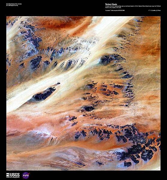
Only 10,000 years ago grasses covered the Sahara Desert and mammals such as lions and elephants roamed the land. Now only two percent of the Sahara hosts oases, patches of land usually centered on natural water springs where crops will grow and where nearly two million people live. In this enhanced satellite image, a series of dark rocky outcroppings contrast with colorful windblown rivers of sand near the Terkezi Oasis in Chad. Image courtesy of USGS.

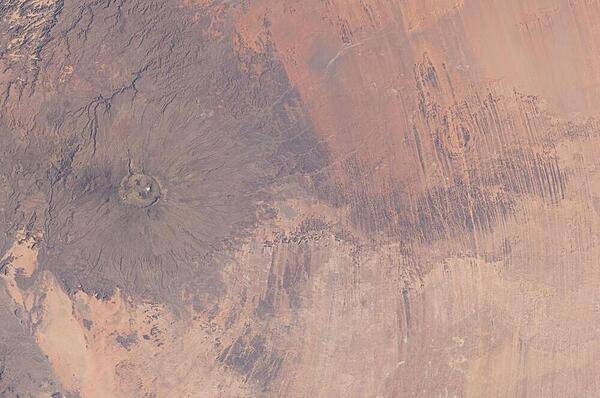
Emi Koussi Volcano and Aorounga Impact Crater in Chad are featured in this striking image photographed from the International Space Station. The two circular landscape features show craters produced by very different geological processes. At left, the broad grey-green shield volcano of Emi Koussi is visible (its 3,415 m summit is the highest in the Sahara region). The circular Aorounga Impact Crater is located approximately 110 km to the southeast of Emi Koussi and has its origin in forces from above rather than eruptions from below. The Aorounga structure is thought to record a meteor impact approximately 345-370 million years ago. Image courtesy of NASA.

Aorounga Impact Crater, located in the Sahara Desert of north-central Chad, is one of the best-preserved impact structures in the world. The crater is thought to be about 345-370 million years old, based on the age of the sedimentary rocks deformed by the impact. Radar data suggests that Aorounga is one of a set of three craters formed by the same impact event. The other two suggested impact structures are buried by sand deposits. Image courtesy of NASA.

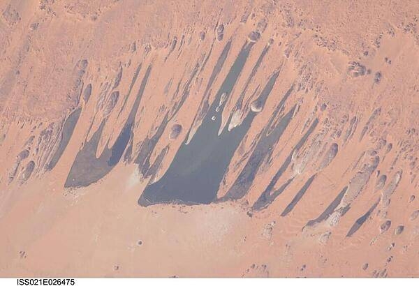
The Ounianga Lakes in northeastern Chad are featured in this image from the International Space Station. This view features one of the largest of a series of ten, mostly fresh water lakes in the Ounianga basin in the heart of the Sahara Desert. The lakes are the remnant of a single large lake - probably tens of kilometers long - that once occupied this remote area approximately 14,800 to 5,500 years ago. As the climate dried out during the subsequent millennia, the lake was reduced in size and large wind-driven sand dunes invaded the original depression dividing it into several smaller basins. The area shown in this image measures approximately 11 x 9 km, with the dark water surfaces of the lake segregated almost completely by orange linear sand dunes that stream into the depression from the northeast. The almost year-round northeast winds and cloudless skies make for very high evaporation (an evaporation rate of greater than 6 m per year has been measured in one of the nearby lakes). Nonetheless, only one of the ten lakes is saline because a very large aquifer reaches the surface in the Ounianga depression in the form of the lakes. The aquifer is large enough to keep supplying the small lakes with water despite the high evaporation rate. Mats of floating reeds also reduce the evaporation in places. The lakes form a hydrological system that is unique in the Sahara Desert. Image courtesy of NASA/Jeffrey Williams.
