President Roosevelt with one of the rare OSS-made globes.
This is part of our series profiling CIA officers working in occupations not commonly associated with the Agency. We talk with them about their daily challenges and rewards, as well as some exceptional moments.
The CIA’s Directorate of Analysis (DA) provides the president and senior policymakers with written intelligence assessments on national security issues. The DA is relying increasingly on cartographers to help analysts visually communicate complex intelligence stories. DA cartographers produce reference maps and map folios, thematic maps that illustrate intelligence stories, and interactive multimedia products for intelligence assessments that go to policymakers. Here is the story of a cartographer who found his dream job at CIA.

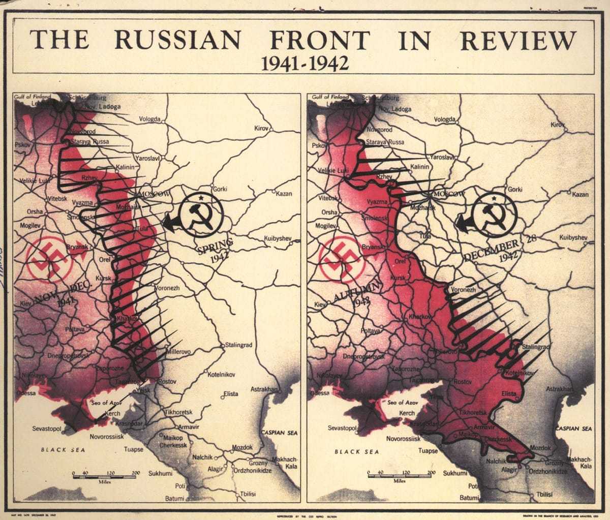
1942 OSS map: Russian Front.
Why did you choose to work at the CIA?
In my college courses, I was really drawn to the presentation side of geography and geographic information systems (GIS) rather than the analysis side. In other words, I wanted to focus on making maps and not worry about data collection and analysis. That is not usual in GIS careers.
But when the CIA recruited on my college campus, they described how their cartographers strictly focus on the craft of conveying intelligence in a visual manner to US policymakers. I was hooked! I knew this was a way I could both serve my country and truly have my dream job right out of college!
How are maps made these days?
Long gone are the days of pens, airbrushes, and hand-placed type. Cartographers get a lot of information from satellites and other aerial platforms, which is then converted to digital data. We take that data—coastlines, cities, rivers, roads, boundaries, and so forth—and combine it with any other data that the intelligence analyst may provide. Our task then is to choose the right way to show that data to tell the story using color, line weight, size, symbols, or any other visual attribute. We want the most important thing to stand out and the “nice to have but not as important” information to be present but not call much attention to itself.
African elephant pop. CIA map 2013.

African elephant pop. CIA map 2013.
What kind of maps do you make?
Most maps I make are thematic maps, or maps that tell a story. A policymaker, warfighter, or analyst may need to know where events are taking place, how goods or people are moving from one place to another, or the risk to US equities around the world. I collaborate with those writing the intelligence pieces to find the most compelling way to convey the intelligence analysis to those needing the information. Only occasionally do I create a purely reference map, which are desired by those seeking general knowledge of an area.
How much do you use your GIS skills?
I use many of my core GIS skills every day such as understanding projections, quantitative methods, and data formats. I specialize in the visual display of the intelligence story, so most data collection and analysis is done by the analysts we collaborate with.

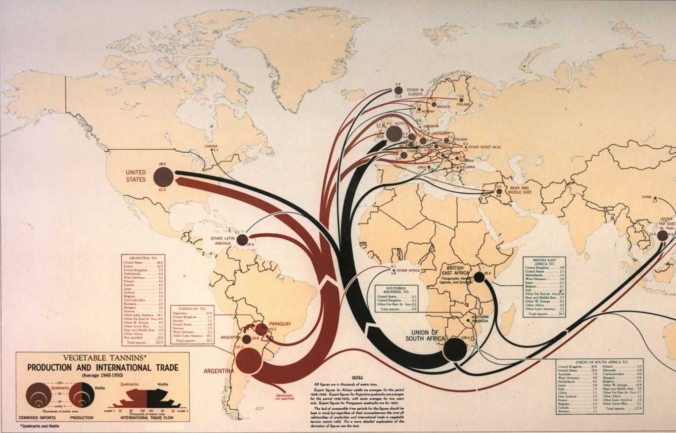
1950 CIA Map: International Trade
What is a typical day for you like?
Each day is a little different. At any given time, I have eight to ten projects that are at varying stages of development. One part of my day might be spent meeting with an analyst to determine the best way to approach their analysis while another part might be working on the actual map.
My projects often require coordination with graphic designers or publications officers (editors), so I may meet with them to review consistency in colors, typefaces, and content. The Agency is also a big proponent of continuing education, so some days I may attend a class or seminar.
What is your favorite thing about this job?
For me, I wanted a career where I could focus on creating beautiful, effective maps. As an Agency cartographer, that is my daily focus. I love the satisfaction that comes with knowing my skills—combined with those of so many other talented individuals—are utilized to help inform policy and protect our country from threats abroad.
Want to Learn More about Cartography at CIA?
- The Mapmaker’s Craft: A History of Cartography at CIA
- Marion Frieswyk: The First Female Intelligence Cartographer
- Interested in becoming a CIA Cartographer? Apply here.
- For related jobs, like geographer, graphic’s designer, etc, see our Careers Page for more information.

